
GeoLocity · Subsurface report
The developer already has a map of what’s under your land.Now you do too.
Walk into the meeting with the same information the developer brought:
- data centers near you — built, under construction, or in the works
- the aquifer and water resources they may draw on
- the climate record since 1990: how many 100°F days a year, then and now
- rare earth and critical minerals mapped under the land
- the ground’s record: faults, floods, fires and nearby EPA sites
25+ resources. One address. Free first look, no card required.


resources
address
seconds
once
Every report checks for
Here is what this means for you
Someone hands you a lease, an offer to buy, a permit for a parcel near yours. Before you sign anything, sell anything, or read about it in the headlines, you can see what the other side already knows, all mapped to your address, a coordinate, or a dropped pin.
Before you sell or lease, make sure your parcel doesn’t sit in an area recently flagged for rare earth or critical minerals.*
Who this is for
What to bring to your next conversation
Homeowners and landowners
You have one parcel and a growing list of questions about what’s under it and around it.
- The offer or lease in your hand, checked against what’s actually recorded on the parcel.
- Which data centers are nearby, and the water and power* they may need.
- The aquifer your community shares, before the county votes on the next project.
- What’s being permitted or proposed around your neighborhood right now.
- Start free: look up your own address before you decide anything.
* Power lines and grid maps aren’t part of the report yet.
Real estate agents
Bring transparency to the transaction before your client is under contract.
- The geology surprise mid-escrow: know what’s under a property before the buyers are already committed and you’re covering extra inspections out of pocket.
- The FEMA and fault flag, early: get flood zone and fault-line records before the buyer goes under contract, not when it’s time to order the Natural Hazard Disclosure.
- The well water question: on a parcel running on well water alone, see what’s being built nearby that could draw on the same source.
- Working more than one property? The five-report pack covers a portfolio at once.
Businesses and researchers
Attorneys, title reps, and mineral rights professionals verify what’s recorded for a living. This gives you the same records assembled in one place, before you start the deeper search.
- A first-pass record of mineral occurrences and federal critical-mineral survey zones, before you order a full mineral rights search.
- The state’s default rule on whether mineral rights travel with the land, plus nearby federal mineral-activity cases.
- The aquifer and any nearby industrial water demand, when hydrology plays into the transaction.
- A PDF your client can hold alongside your own findings.
How it works
One address. Sixty seconds. One report, the whole picture.
Enter the address, drop a pin, or type a coordinate.
Any US address, a dropped pin, or a coordinate: yours, a neighbor’s, or one you’re considering. Basic findings return in about sixty seconds.
Read the scorecard.
It’s a first look, not the full record: nearby data centers, mineral flags, flood and fault zones, enough to see if something’s there. Decide from there whether the complete report is worth pulling.
Get the Complete Report.
One PDF with every layer: minerals, aquifer, water demand, the climate record back to 1990, bedrock, hazards, and the state’s rule on mineral rights. One parcel, one time. Nothing recurring.
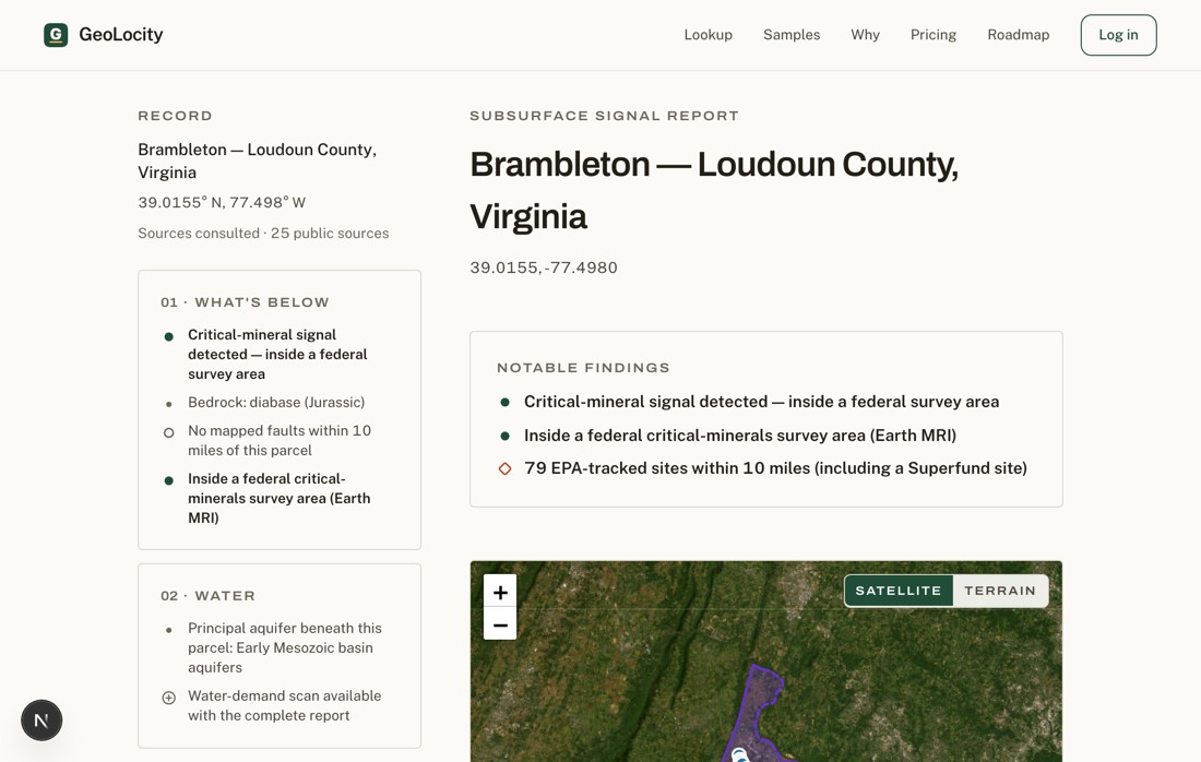
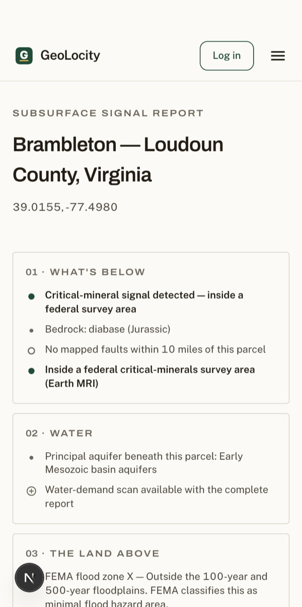
Three real reports
See a full report before you run yours.
Why this exists
The data is public. The map was missing.
The records already exist. Mineral surveys sit in one federal database, aquifer maps in another, climate records in a third, and flood maps in a fourth. Nobody assembled them into one page for one address, so the developer with the budget for a team got the whole picture and the landowner didn’t.
GeoLocity pulls those records for one parcel and puts them on one page. Sometimes that page turns up a mineral claim, a shared aquifer, or a data center under construction two miles out. Sometimes it turns up nothing notable at all, and that’s a finding too: a clear record is worth knowing before you sign, not just a full one.
* The federal government is investing $320 million in Earth MRI, the USGS program mapping where critical minerals may lie under U.S. land — public and private — as part of roughly $10 billion in federal critical-minerals investment since January 2025. Survey areas are added every year.
What it costs
Start Free. Pay for the parcel that matters.
Most people learn what their land holds only after someone else already knows. From here, you’re the one who checked first.
This is the look before you decide anything: a free scan of your address, no card required.
- Know in 60 seconds whether your parcel holds anything worth a closer look
- Your safety headlines are free, always: flood zone, fire history, landslides, environmental sites
- 13 live checks across minerals, water, the land above, and rights, one status line each
This is the moment you stop guessing: the full record for one parcel, minerals to mineral rights status, for $19.99, once.
- Walk into your sale or offer knowing exactly what the records show
- See every recorded mineral occurrence mapped to your parcel, with pins
- Know who else is drawing on your groundwater nearby before it becomes a problem
- Get the rights read plus nearby federal mineral-activity cases in one place
- Keep the full PDF: print it, share it, hand it to your attorney
This is the moment you’re checking more than one address, a listing, a rental, a family member’s place, for $39.99, once.
- Five complete reports, spend one credit per parcel
- Use them on any parcels you’re comparing, no rush, good for 12 months
- Every credit unlocks the same full report: minerals, water, rights, the recorded history